


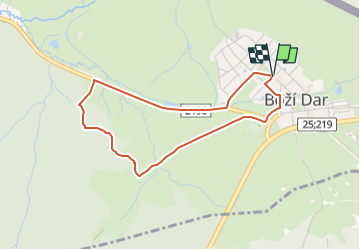

8,4 km | 12,9 km-effort

Tous les sentiers balisés d’Europe GUIDE+


Application GPS de randonnée GRATUITE
 SityTrail
IGN / Instituts géographiques
SityTrail World
Le monde est à vous
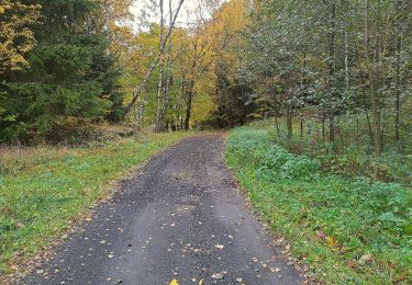
Randonnée A pied de 3,3 km à découvrir à Severozápad, Karlovarský kraj, Boží Dar. Cette randonnée est proposée par SityTrail - itinéraires balisés pédestres.
Randonnée créée par cz:KČT.
learning educational path


A pied
![Randonnée A pied Saint-Joachimsthal - [Ž] Klínovec - Radošov - Photo](https://media.geolcdn.com/t/375/260/45832ed6-7d58-4e59-9ee7-9272ace5bf81.jpeg&format=jpg&maxdim=2)
A pied
A pied
A pied

A pied
A pied
A pied
A pied
A pied